
Moon LRO LROC NAC Boulder Database v1 Watkins
- Primary Authors
- Ryan Watkins
- Originators
- USGS Astrogeology Science Center
- Publisher
- USGS Astrogeology Science Center
- Publication Date
- 2019-09-09
- Abstract
-
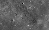
The Lunar Boulder Database contains boulder distributions around small (< 1 km), young (< 200 Ma) lunar impact craters located near spacecraft landing sites. Boulders were manually identified and measured on images from the Lunar Reconnaissance Orbiter (LRO) with the Lunar Reconnaissance Orbiter Camera (LROC) Narrow Angle Camera (NAC; Robinson et al., 2010) at scales of ~0.5-2 m/pixel. LROC NAC images allow for boulders ~1-2m in size and larger to be identified and measured.
These boulder distributions are being used to understand boulder degradation rates on the lunar surface, and to assess landing site hazards for future surface missions to the Moon. This dataset is being archived in the Planetary Data System (PDS) for use in future boulder distribution and landing hazard studies. Future boulder counts and any refinements to existing measurements will be uploaded into subsequent versions of this dataset.
This archive uses PDS4 archiving standards. An overview of PDS4 is provided in the PDS4 Concepts document (2018) and the standards are specified in the PDS4 Standards Reference (2018). References: Anderson, J. A., Sides, S. C., Soltesz, D. L., Sucharski, T. L., & Becker, K. J. (2004). Modernization of the Integrated Software for Imagers and Spectrometers. Paper presented at the 35th Lunar and Planetary Science Conference, Lunar and Planetary Institute, Houston, TX. https://www.lpi.usra.edu/meetings/lpsc2004/pdf/2039.pdf Kneissl, T., van Gasselt, S., & Neukum, G. (2011). Map-projection-independent crater size-frequency determination in GIS environmentsâNew software tool for ArcGIS. Planetary and Space Science, 59(11), 1243â1254. https://doi.org/10.1016/j.pss.2010.03.015 Nava, R. (2011). Crater Helper Tools for ArcGis 10.0 Reference Manual. ftp://pdsimage2.wr.usgs.gov/pub/pigpen/ArcMap_addons/Crater%20Helper%20Tools%20for%20ArcGIS%2010%20-%20Reference%20Manual_062811.pdf Robinson, M. S., Brylow, S. M., Humm, D., Lawrence, S. J., Thomas, P. C., Denevi, B. W., Bowman-Cisneros, E., et al. (2010). Lunar Reconnaissance Orbiter Camera (LROC) Instrument Overview. Space Science Review, 150(1), 81â124. https://doi.org/10.1007/s11214-010-9634-2 Watkins, R. N., Jolliff, B. L., Fogerty, C., Mistick, K., Singer, K. N., & Lawrence, S. J. (2018). Boulder Distributions Around Young, Small Lunar Impact Craters. Paper presented at the 49th Lunar and Planetary Science Conference, Lunar and Planetary Institute, Houston, TX. https://www.hou.usra.edu/meetings/lpsc2018/pdf/1201.pdf Watkins, R. N., Jolliff, B. L., Lawrence, S. J., Hayne, P. O., & Ghent, R. R. (2017). Boulder Distributions at Legacy Landing Sites: Assessing Regolith Production Rates and Landing Site Hazards. Paper presented at the 48th Lunar and Planetary Science Conference, Lunar and Planetary Institute, Houston, TX. https://www.hou.usra.edu/meetings/lpsc2017/pdf/1245.pdf Watkins, R. N., Mistick, K., Jolliff, B. L., & Lawrence, S. J. (2018). Boulder Distributions Around Young Lunar Impact Craters: Case Study of South Ray Crater. Paper presented at the 49th Lunar and Planetary Science Conference, Houston, TX. https://www.hou.usra.edu/meetings/lpsc2018/pdf/1146.pdf
- Purpose
- Created as part of a project funded by NASAâS Lunar Data Analysis Program (LDAP), the purpose of this dataset is to provide locations and diameters of boulders around small, young impact craters on the Moon. These boulder counts were conducted as part of a study aimed at determining regolith production rates and assessing landing site hazards, as discussed in the associated publications. Researchers are encouraged to read the publications and data description document to understand how the data was acquired and used.
Contact and Distribution
- Format
- Tabular Data
- Access Scope
- PDS
- Native Data Set Environment
- Astrogeology Theme
- Impact Crater, Regolith
- Mission Names
- Lunar Reconnaissance Orbiter
- Instrument Names
- LROC
- Online Package Link
- https://astrogeology.usgs.gov/search/map/moon_lro_lroc_nac_boulder_database_v1_watkins
- External File Size
- 185154475
- Online File Link
- http://astropedia.astrogeology.usgs.gov/download/Moon/Research/Regolith/lunar_boulder_data_bundle
- Access Instructions
- CSV file reader
- Contact Address
- 2255 N. Gemini Drive
- Contact City
- Flagstaff
- Contact State
- AZ
- Contact Postal Code
- 86001
- Contact Email
- [email protected]
- Source Online Linkage
- https://pdsimage2.wr.usgs.gov/Individual_Investigations/moon_lro_lroc_boulderdata_watkins_2018/
- Source PDS Archive
- Lunar Reconnaissance Orbiter
- PDS Status
- PDS 4 In Review
Geospatial Information
- Target
- Moon
- System
- Earth
- Object Type
- Grid Cell
- Quad Name
- Horizontal Coordinate System Units
- Degrees


