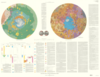
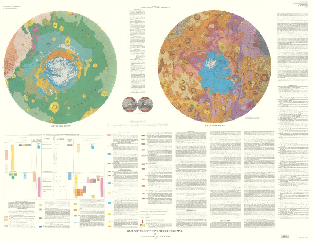
Mars Geologic Map of the Polar Regions
- Originators
- K. Tanaka, D. Scott
- Publisher
- USGS Astrogeology Science Center
- Publication Date
- 1999-01-06
Contact and Distribution
- Format
- Geologic Map, Polar Map, Raster Data, Vector Data
- Access Scope
- RPIF
- Series Id
- 1802-C
- Native Data Set Environment
- Astrogeology Theme
- Cartography, Geology, Geomorphology, Photogeology, Planetary evolution, Stratigraphy
- Online Package Link
- https://astrogeology.usgs.gov/search/map/mars_geologic_map_of_the_polar_regions
- External File Size
- 15590559
- Online File Link
- http://astropedia.astrogeology.usgs.gov/download/Mars/Geology/year-1990/Mars-Geologic-Map-of-the-Polar-Regions.pdf
- Access Instructions
- 1 remote-sensing image ;61 x 60 cm., on sheet 94 x 66 cm., folded in envelope 30 x 24 cm.
- Contact Address
- 2255 N. Gemini Drive
- Contact City
- Flagstaff
- Contact State
- AZ
- Contact Postal Code
- 86001
- Contact Email
- [email protected]
Geospatial Information
- Target
- Mars
- Well Known Text (WKT)
- MULTIPOLYGON (((0 90, 360 90, 360 55, 0 55, 0 90)), ((0 -55, 360 -55, 360 -90, 0 -90, 0 -55)))
- Minimum Latitude
- -90
- Maximum Latitude
- 90
- Minimum Longitude
- 0
- Maximum Longitude
- 360
- Object Type
- Grid Cell
- Quad Name
- Map Scale (hard-copy)
- 1:15000000
- Map Projection Name
- Polar Stereographic