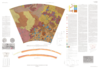
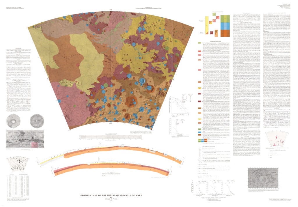
Mars Geologic Map of the Hellas Quadrangle
- Originators
- D. Potter
- Publisher
- USGS Astrogeology Science Center
- Publication Date
- 2019-10-15
Contact and Distribution
- Format
- Geologic Map, Raster Data, Vector Data
- Access Scope
- RPIF
- Series Id
- 941
- Native Data Set Environment
- Astrogeology Theme
- Cartography, Geology, Geomorphology, Photogeology, Planetary evolution, Stratigraphy
- Online Package Link
- https://astrogeology.usgs.gov/search/map/mars_geologic_map_of_the_hellas_quadrangle
- External File Size
- 10068673
- Online File Link
- http://astropedia.astrogeology.usgs.gov/download/Mars/Geology/year-1970/Mars-Geologic-Map-of-the-Hellas-Quadrangle.pdf
- Access Instructions
- 1 map :col. ;51 x 70 cm. fold. in envelope 30 x 24 cm.
- Contact Address
- 2255 N. Gemini Drive
- Contact City
- Flagstaff
- Contact State
- AZ
- Contact Postal Code
- 86001
- Contact Email
- [email protected]
Geospatial Information
- Target
- Mars
- Well Known Text (WKT)
- MULTIPOLYGON (((60 -30, 120 -30, 120 -65, 60 -65, 60 -30)))
- Minimum Latitude
- -65
- Maximum Latitude
- 0
- Minimum Longitude
- 60
- Maximum Longitude
- 120
- Object Type
- Grid Cell
- Quad Name
- MC-13, MC-14, MC-21, MC-22, MC-27, MC-28, MC-29, MC-30
- Map Scale (hard-copy)
- 1:5000000
- Map Projection Name
- Lambert Conformal