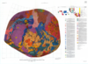
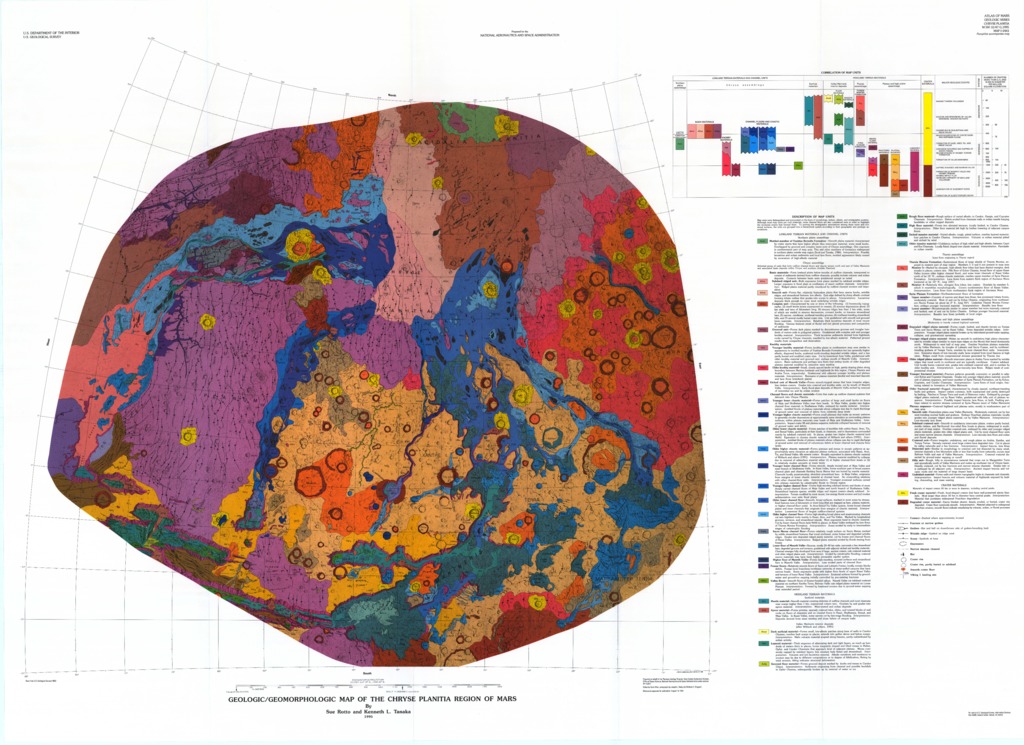
Mars Geologic/Geomorphic Map of the Chryse Planitia Region
- Originators
- S. Rotto, K. Tanaka
- Publisher
- USGS Astrogeology Science Center
- Publication Date
- 1996-01-03
Contact and Distribution
- Format
- Geologic Map, Raster Data, Vector Data
- Access Scope
- RPIF
- Series Id
- 2441
- Native Data Set Environment
- Astrogeology Theme
- Cartography, Geology, Geomorphology, Photogeology, Planetary evolution, Stratigraphy
- Online Package Link
- https://astrogeology.usgs.gov/search/map/mars_geologic_geomorphic_map_of_the_chryse_planitia_region
- External File Size
- 16135225
- Online File Link
- http://astropedia.astrogeology.usgs.gov/download/Mars/Geology/year-1990/Mars-GeologicGeomorphic-Map-of-the-Chryse-Planitia-Region.pdf
- Access Instructions
- 1 remote-sensing map :col. ;86 x 93 cm., on sheet 101 x 140 cm., folded in envelope 30 x 24 cm. +1 pamphlet (10 p. ; 28 cm.)
- Contact Address
- 2255 N. Gemini Drive
- Contact City
- Flagstaff
- Contact State
- AZ
- Contact Postal Code
- 86001
- Contact Email
- [email protected]
Geospatial Information
- Target
- Mars
- Well Known Text (WKT)
- MULTIPOLYGON (((276 45, 350 45, 350 -20, 276 -20, 276 45)))
- Minimum Latitude
- -20
- Maximum Latitude
- 45
- Minimum Longitude
- 276
- Maximum Longitude
- 350
- Object Type
- Grid Cell
- Quad Name
- MC-3, MC-4, MC-18, MC-19
- Map Scale (hard-copy)
- 1:5000000
- Map Projection Name
- Stereographic