Mars Image Control Network
- Publisher
- USGS Astrogeology Science Center
- Abstract
-
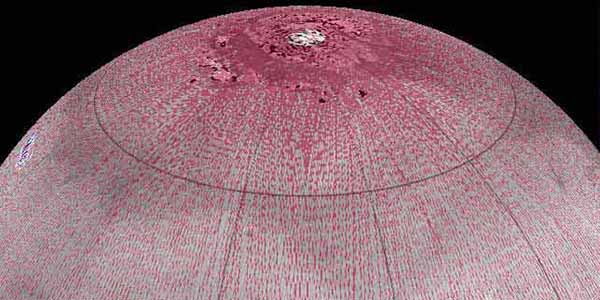
Positional control for the MDIM 2.1 global mosaic came from a geodetic/photogrammetric solution of the global Mars Mariner 9 and Viking image control network. The details of this network solution are described here. This network incorporates 1,054 Mariner 9 and 5,317 Viking Orbiter images. Accuracy of the new solution is improved primarily as the result of constraining all 37,652 control points to radii from Mars Orbiter Laser Altimeter (MOLA) data and adding 1,232 "ground control points" whose horizontal coordinates are also constrained by MOLA. The MOLA data are believed to have an absolute accuracy on the order of 100 m horizontally. Additional improvements result from use of updated timing and orientation data for the Viking Orbiter images, improved reseau measurements and hence distortion correction of the images, and careful checking and remeasurement of control points with large residuals. The RMS error of the solution is 15.8 m (~1.3 Viking pixels, ~280 m on the ground). The IAU/IAG 2000 coordinate system is used for the network and the mosaic.
Primary Reference: Archinal, B. A., Lee, E. M., Kirk, R. L., Duxbury, T. C., Sucharski, R. M., Cook, D. A. and Barrett, J. M., 2004, A New Mars Digital Image Model (MDIM 2.1) Control Network, XXth Congress of the International Society of Photogrammetry and Remote Sensing, Commission IV, WG IV/9, 12-23 July, Istanbul, Turkey. Acknowlegements
Contact and Distribution
- Format
- Control Network
- Access Scope
- Astrogeology
- Mission Names
- Mariner 9, Viking Orbiter
- Instrument Names
- MOLA
- Online Package Link
- https://astrogeology.usgs.gov/search/map/mars-image-control-network
Geospatial Information
- Target
- Mars


