Lunar and Planetary Cartographic Catalog
Download
Original
(pdf) 1 MB
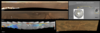
MER Image Science Foldout
Mimetype
application/pdf
Filename
Science_MERB_Foldout_v2.pdf
Originator
USGS Astrogeology Science Center
Group
Added to Astropedia
28 October 2011
Modified
9 July 2013
Geospatial Information
Quad Name
FGDC:
xml metadata
Related Products
Surface processes recorded by rocks and soils on Meridiani Planum, Mars: Microscopic Imager observations during Opportunity’s first three extended missions
MER Image Science Foldout
Evidence from Opportunity's Microscopic Imager for Water on Meridiani Planum
Textures of the Soils and Rocks at Gusev Crater from Spirit’s Microscopic Imager
Overview of the Microscopic Imager Investigation during Spirit’s first 450 sols in Gusev crater
1
2
ISIS
Planetary Nomenclature
Map a Planet 2
PDS Cartography and Imaging Science Node
RPIF
Photogrammetry Guest Facility
PILOT
MRCTR GIS Lab