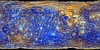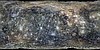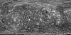
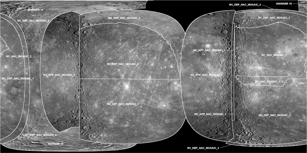
Mercury Messenger Global Mosaic 2010 Observation Guide
Observation Guide labeling the individual images used to make up the 2010 Mercury Messenger Global Mosaic.
- Mimetype
- application/isis
- Filename
- Mercury_M1_M2_M3_M10_MosaicObsGuide.cub
- Originator
- USGS Astrogeology Science Center
- Group
- Added to Astropedia
- 10 June 2013
- Modified
- 31 October 2017
General
- Geospatial Data Presentation Form
- Global Mosaic
- Native Data Set Environment
- ISIS v3
Keywords
Geospatial Information
- Minimum Latitude
- -90
- Maximum Latitude
- 90
- Minimum Longitude
- -180
- Maximum Longitude
- 180
- Direct Spatial Reference Method
- Raster
- Object Type
- Pixel
- Lines (pixels)
- 3833
- Samples (pixels)
- 7666
- Quad Name
- Radius A
- 2440000
- Radius C
- 2440000
- Bands
- 1
- Horizontal Coordinate System Units
- Meters
- Map Projection Name
- Equirectangular
- Latitude Type
- Planetocentric
- Longitude Direction
- Positive East
- Longitude Domain
- -180 to 180