Lunar and Planetary Cartographic Catalog
Download
Browse
(jpg) 512 x 512
Original
(pdf) 130 kB
Analysis of Multi-Angle Infrared Observations of the Mars South Polar Cap Abstract for TES Workshop
Mimetype
application/pdf
Filename
TESwksp_titus_epf.pdf
Author
Vicky Hamilton
Originator
USGS Astrogeology Science Center
Group
Added to Astropedia
20 October 2011
Modified
11 June 2021
General
Geospatial Data Presentation Form
Document
Keywords
Target
Mars
Geospatial Information
Quad Name
FGDC:
xml metadata
Related Products
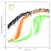
Application of a Sintering Model to the Analysis of TES Spectra of the Seasonal Caps
Animation of 1997 South Polar Cap Recession
Animation of 1999 South Polar Cap Recession
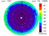
1999 Plot of South Pole Bolometer Temperatures
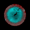
South Pole Cryptic Region
1
2
3
ISIS
Planetary Nomenclature
Map a Planet 2
PDS Cartography and Imaging Science Node
RPIF
Photogrammetry Guest Facility
PILOT
MRCTR GIS Lab