Sol 2 Update on Curiosity from USGS Scientist, Ken Herkenhoff: Planning Report
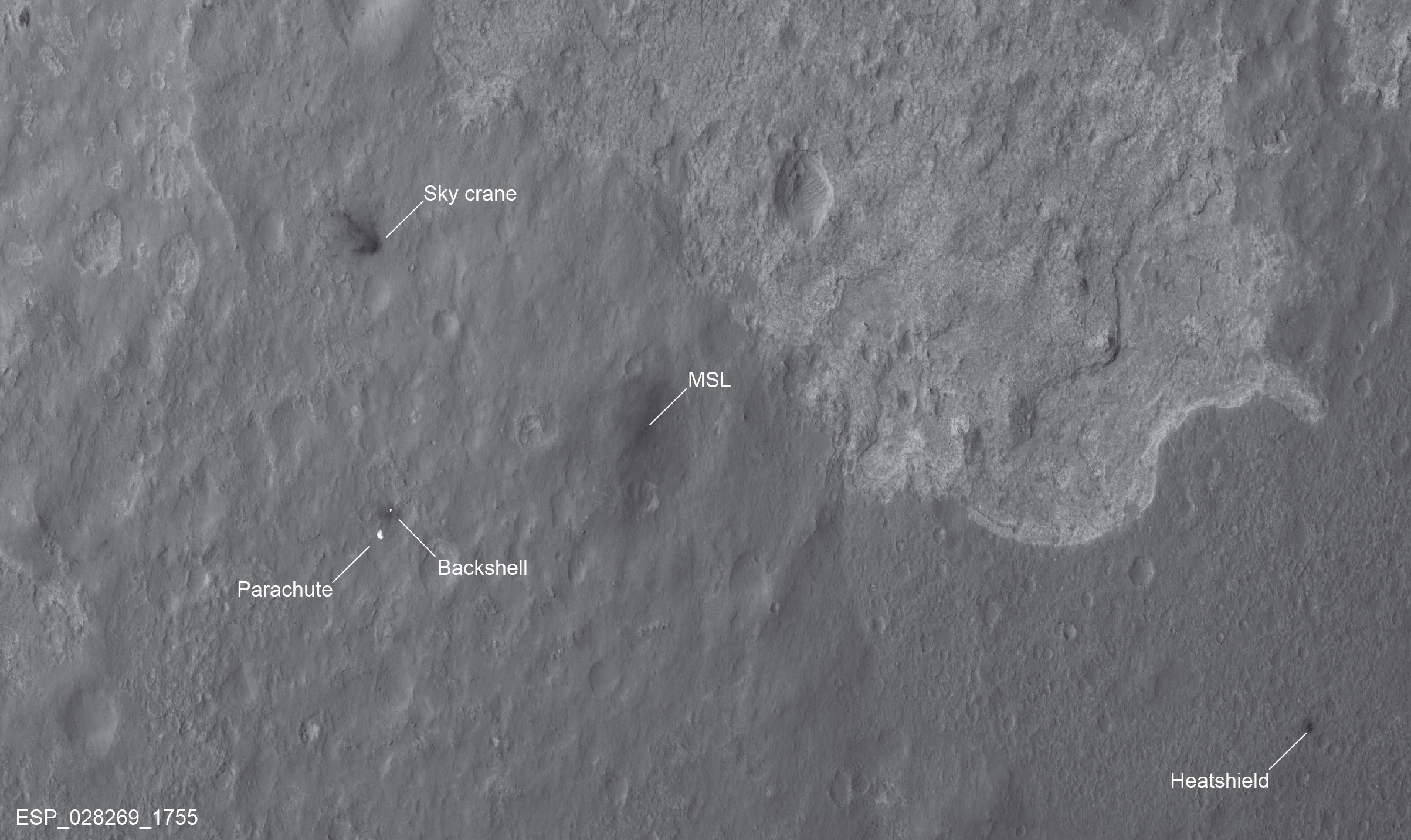
7 August 2012Today I'm working as Science Uplink Representative again, planning Sol 2 activities. We now know exactly where MSL is, thanks to more good work by the MRO HiRISE team: They acquired a new image of the landing area that shows not only the rover, but its heat shield, parachute, and descent stage, all in the same image! So the MSL team is starting to plan where to drive, but I have not been directly involved in those discussions because they have been occurring during first shift. Certainly we must move out of the area contaminated by the landing rockets before analyzing samples of the soil. The plan for today includes deploying the remote sensing mast, obviously an important activity, as we cannot use the mast cameras and ChemCam instrument until the mast is deployed. Once the mast has been deployed, the navigation cameras will take a full, 360-degree panorama of the terrain around us and another panorama of the rover deck. Based on the hazard avoidance camera images received so far, the Navcam panorama should be spectacular! During one of the tactical planning meeting today, we were interrupted by the Project Manager for a surprise visit from U.S. Congressman John Culberson of Texas. He was impressed by the mission operations area and vowed to protect us from interference from NASA Headquarters, so that we can do our jobs efficiently. I'm not particularly fond of politicians, but it was an honor to hear him thank us for our efforts and we all applauded after his brief speech. Hopefully he will vote to restore funding for NASA's Mars Program in fiscal 2013! Ken


