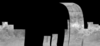
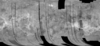
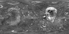
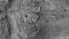
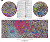
Astrogeology Science Center

USGS

Pages

105 Results Collapse
LPSC 2013 Town Hall on Planetary Mapping and Cartography thumbnail

LPSC 2013 Town Hall on Planetary Mapping and Cartography

http://astrogeology.usgs.gov/groups/2013-planetary-mapping-town-hall

What is planetary mapping? When do you need to do planetary mapping? How is planetary mapping accomplished? Why is planetary mapping important to you? Planetary mapping is literally foundational to…

About thumbnail

About

http://astrogeology.usgs.gov/links/about

The USGS Astrogeology Science Center has a rich history of participation in space exploration and planetary mapping, starting in 1963 when the Flagstaff Science Center was established to provide…

Apollo Mission thumbnail

Apollo Mission

http://astrogeology.usgs.gov/missions/apollo

The USGS was involved in multiple ways, very early in the Apollo program, including high-resolution mapping of the landing spots. Starting in 1963, the USGS Astrogeology Research Program also played…

ASPRS Southwest US Region Regional Technical Meeting thumbnail

ASPRS Southwest US Region Regional Technical Meeting

http://astrogeology.usgs.gov/groups/asprs-southwest-technical-meeting

photogrammetry, remote Sensing and GIS in Extreme Environments ASPRS Southwest US Region Regional Technical Meeting USGS Astrogeology Science Center Flagstaff, Arizona - Fall of 2012. The exact date…

Astrogeology 50th Anniversary thumbnail

Astrogeology 50th Anniversary

http://astrogeology.usgs.gov/about/astrogeology-50th-anniversary

The USGS Astrogeology Science CenterHonoring 50 Years of Public Service: Exploring the Solar System from Flagstaff, AZThe USGS Astrogeology Science Center Honoring 50 Years of Public Service:…

Products

1 Result Collapse
Apollo 12 Color Panorama thumbnail

Apollo 12 Color Panorama

image/jpeg 390 kB

The panorama was collected by Charles "Pete" Conrad.

Download (jpg) 390 kB
Gusav Crater MER Landing Site Ellipse THEMIS IR Mosaic thumbnail

Gusav Crater MER Landing Site Ellipse THEMIS IR Mosaic

application/isis 23 MB

In 2003-2005, the USGS worked under the guidance of NASA's Mars Critical Data Products Initiative to conduct research on how controlled large area or global 2001 Mars Odyssey THEMIS IR image mosaics…

Download (cub) 23 MB
Mercury Messenger Global Mosaic 2010 thumbnail

Mercury Messenger Global Mosaic 2010

application/isis 2 GB

This mosaic represents the best geodetic map of Mercury's surface to date. MESSENGER's three flybys alone provide 90.90% of the data in the global mosaic. Although MESSENGER went in to safe mode…

Download (cub) 2 GB
Mars Viking Image Mosaic Globe thumbnail

Mars Viking Image Mosaic Globe

application/pdf 3 MB

Download (pdf) 3 MB
Moon Clementine Topographic Globe thumbnail

Moon Clementine Topographic Globe

application/pdf 3 MB

Download (pdf) 3 MB

Documents

137 Results Collapse

News

313 Results Collapse

Beta Testing Begins

Pgm News: 23 January 2013

The beta testing of the new PGM site is starting.

Cerberus Fossae Expanded

Nomenclature News: 11 October 2007

The boundary of the Martian feature Cerberus Fossae has been expanded to include nearby fossae. Please see the listing in the Gazetteer of Planetary Nomenclature for the new coordinates and size.

Changes to Venus Nomenclature

Nomenclature News: 9 December 2009

The name Mnemosyne Regio has been dropped, and the name Metis Regio has been changed to Metis Mons. For more information, see the Venus section of the Gazetteer of Planetary Nomenclature.

Change to IAU rule

Nomenclature News: 20 March 2006

Rule number 3 on page http://planetarynames.wr.usgs.gov/rules.html has been amended to better describe the circumstances under which planetary features are named.

Coordinates of Named Lunar Features Now Available in LOLA Reference Frame

Nomenclature News: 4 June 2012

In 2012, coordinates of the named features in the lunar portion of the International Astronomical Union (IAU) Working Group for Planetary System Nomenclature (WGPSN) Gazetteer of Planetary…