Products

244 Results Collapse
PDS 2018 Tool Working Group Report thumbnail

PDS 2018 Tool Working Group Report

application/vnd.openxmlformats-officedocument.presentationml.presentation 1 MB

PowerPoint Presentation thumbnail

PowerPoint Presentation

application/vnd.openxmlformats-officedocument.presentationml.presentation 16 MB

FY 2019 Budget Request (PPBE) to Planetary Science Director thumbnail

FY 2019 Budget Request (PPBE) to Planetary Science Director

application/vnd.openxmlformats-officedocument.presentationml.presentation 72 kB

Mars Geologic Map of the Elysium Region GIS Conversion thumbnail

Mars Geologic Map of the Elysium Region GIS Conversion

application/zip 431 MBJul 18 2016

The original map document was created in 1992 as a Mercator projection and is based on older Viking images. It was scanned and georeferenced into ArcGIS in two parts that are located in…

File Format Description thumbnail

File Format Description

application/pdf 14 kB

RAND/USGS Planetary Geodesy (RUPG) Software ISIS QMATCH Program Measurement Input and Output File

Bibliographic References thumbnail

Bibliographic References

application/pdf 26 kB

Modeling and Adjustment of THEMIS IR Line Scanner Camera Image Measurements thumbnail

Modeling and Adjustment of THEMIS IR Line Scanner Camera Image Measurements

application/pdf 269 kB

The overall problem we’re solving is that we want to be able to set up the relationships between the coordinates of arbitrary physical points in space (e.g. ground points) and their coordinates on…

Suggestions for Randlsq Program Parameter Naming thumbnail

Suggestions for Randlsq Program Parameter Naming

application/pdf 17 kB

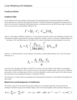
Stuart has suggested that I draft some suggestions for the format and names to be used for parameters in the randlsq.F program. I previously implemented the limited naming of parameters in this…

Lunar Modeling and Database thumbnail

Lunar Modeling and Database

application/pdf 670 kB

Project Pages

2 Results Collapse

Documents

180 Results Collapse
ISPRS 1999 SSI / RAC: Imagers for Mars Polar Lander thumbnail

ISPRS 1999 SSI / RAC: Imagers for Mars Polar Lander

application/pdf 27 kB

The Mars Volatiles and Climate Surveyor (MVACS) instrument payload on the Mars Polar Lander includes two imagers designed and constructed at the Lunar and Planetary Laboratory at the University of…

ISPRS 1999 The UCL IUS-Tithonium Chasma Digital Elevation Model thumbnail

ISPRS 1999 The UCL IUS-Tithonium Chasma Digital Elevation Model

application/pdf 93 kB

We re-examine a previously unpublished digital elevation model (DEM) of a ~105,000km2 area (figure 1) of Tithonium and Ius Chasma area, produced by the EXODUS (Extraterrestrial Orbital DEMs for…

ISPRS 1999 PIGWAD - Planetary Interactive GIS on the Web Analyzable Database thumbnail

ISPRS 1999 PIGWAD - Planetary Interactive GIS on the Web Analyzable Database

application/pdf 573 kB

We are producing a webbased, user-friendly interface built on a powerful Geographic Information System (GIS), that will integrate statistical and spatial relational tools for analyses of planetary…

ISPRS 1999 Location and Geologic Settings for the three U. S. Mars Landers thumbnail

ISPRS 1999 Location and Geologic Settings for the three U. S. Mars Landers

application/pdf 15 kB

Super resolution of the horizon at both Viking landing sites has revealed “new” features we use for triangulation, similar to the approach used during the Mars Pathfinder Mission. We propose…

ISPRS 1999 An Image Map of the Mars Pathfinder Landing Site thumbnail

ISPRS 1999 An Image Map of the Mars Pathfinder Landing Site

application/pdf 13 kB

On 4 July 1997, the Pathfinder spacecraft landed on Mars near the mouth of the outflow channel Ares Vallis, located in the southern part of Chryse Planitia. Between July 4 and September 27, 1997, the…

ISPRS 1999 A New Viking-Based Precise Global Map of Mars thumbnail

ISPRS 1999 A New Viking-Based Precise Global Map of Mars

application/pdf 10 kB

We present a new global map of Mars based on images taken by the Viking Orbiters. Precise image position information and camera pointing data, needed to produce this map, were derived from a recent…

ISPRS 1999 Geometrically Precise Maps and their Applications thumbnail

ISPRS 1999 Geometrically Precise Maps and their Applications

application/pdf 39 kB

We re-analyzed the Viking Mars control point network, an effort, which resulted in accurate pointing data for a list of 1138 Viking Orbiter images. From these images, which have resolutions between…

ISPRS 1999 FIDO / APEX / Athena-Based Plans for Cartographic Products and Rover Localization Analyses thumbnail

ISPRS 1999 FIDO / APEX / Athena-Based Plans for Cartographic Products and Rover Localization Analyses

application/pdf 18 kB

In this abstract we preview the acquisition of stereo image data and resultant cartographic products and rover localization studies associated with the Athena Precursor Experiment (APEX) on the 2001…

ISPRS 1999 Global Mapping and Individual Map Sheets - The Topographic Image Map Series Mars 1:200 000 thumbnail

ISPRS 1999 Global Mapping and Individual Map Sheets - The Topographic Image Map Series Mars 1:200 000

application/pdf 193 kB

More than ever before the planet Mars is subject to exploration and mapping activities. Since 1992 the Technical University of Berlin was involved in the software development for photogrammetric and…

ISPRS 1999 Constraints, Approach, and Status of Mars Surveyor '01 Landing Site Selection thumbnail

ISPRS 1999 Constraints, Approach, and Status of Mars Surveyor '01 Landing Site Selection

application/pdf 13 kB

There are many similarities between the Mars Surveyor '01 (MS '01) landing site selection process and that of Mars Pathfinder. The selection process includes two parallel activities in which…