Products

15 Results Collapse
Mars Geologic Map of MTM -40277, -45277, -40272, and -45272 Quadrangles, Eastern Hellas Planitia Region thumbnail

Mars Geologic Map of MTM -40277, -45277, -40272, and -45272 Quadrangles, Eastern Hellas Planitia Region

image/jpeg 7 MBFeb 10 2010

Hellas Planitia comprises the floor deposits of the Hellas basin, more than 2,000 km across and 8 km deep, which is located in the southern hemisphere's cratered highlands and is the largest…

Mars Geologic Map of MTM 35337, 40337, and 45337 Quadrangles, Deuteronilus Mensae Region thumbnail

Mars Geologic Map of MTM 35337, 40337, and 45337 Quadrangles, Deuteronilus Mensae Region

application/pdf 9 MBJan 09 2009

Deuteronilus Mensae, first defined as an albedo feature at lat 35.0 deg N., long 5.0 deg E., by U.S. Geological Survey (USGS) and International Astronomical Union (IAU) nomenclature, is a gradational…

Mars Geologic Map of MTM -30262 and -30267 Quadrangles, Hadriaca Patera Region thumbnail

Mars Geologic Map of MTM -30262 and -30267 Quadrangles, Hadriaca Patera Region

application/pdf 9 MBJan 07 2007

Introduction Mars Transverse Mercator (MTM) -30262 and -30267 quadrangles cover the summit region and east margin of Hadriaca Patera, one of the Martian volcanoes designated highland paterae. MTM…

Mars Geologic Map of MTM -45252 and -45257 Quadrangles, Reull Vallis Region thumbnail

Mars Geologic Map of MTM -45252 and -45257 Quadrangles, Reull Vallis Region

application/pdf 8 MBJan 03 2003

Mars Transverse Mercator (MTM) quadrangles -45252 and -45257 (latitude 42.5° S. to 47.5°S., longitude 250° W. to 260° W.) cover a portion of the highlands of Promethei Terra east of…

Mars Geologic Map of MTM -40252 and -40257 Quadrangles, Reull Vallis Region thumbnail

Mars Geologic Map of MTM -40252 and -40257 Quadrangles, Reull Vallis Region

application/pdf 16 MBJan 02 2002

Mars Transverse Mercator (MTM) quadrangles -40252 and -40257 cover a portion of the highlands of Promethei Terra northeast of the Hellas basin. The map area consists of heavily cratered ancient…

Mars Geologic Map of the Hellas Region thumbnail

Mars Geologic Map of the Hellas Region

application/pdf 32 MBJan 01 2001

INTRODUCTION This geologic map of the Hellas region focuses on the stratigraphic, structural, and erosional histories associated with the largest well-preserved impact basin on Mars. Along with the…

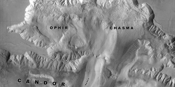
Mars Geologic Map of Ophir and Central Candor Chasmata (MTM -05072) thumbnail

Mars Geologic Map of Ophir and Central Candor Chasmata (MTM -05072)

application/pdf 20 MBJan 07 2000

The geologic map of Ophir and central Candor Chasmata is one of a series of 1:500,000 scale maps prepared for areas on Mars that are of particular scientific interest and may serve as potential…

Valles Marineris Hemisphere Enhanced thumbnail

Valles Marineris Hemisphere Enhanced

image/tiff 27 MB

Mosaic of the Valles Marineris hemisphere of Mars projected into point perspective, a view similar to that which one would see from a spacecraft. The distance is 2500 kilometers from the surface of…

Valles Marineris Hemisphere Unenhanced thumbnail

Valles Marineris Hemisphere Unenhanced

image/tiff 24 MB

Mosaic of the Valles Marineris hemisphere of Mars projected into point perspective, a view similar to that which one would see from a spacecraft. The distance is 2500 kilometers from the surface of…

Mars Mini Globes thumbnail

Mars Mini Globes

application/pdf 2 MB

Project sheet with instructions for creating the Viking and Global Surveyor Mars globes using tennis balls.

Project Pages

1 Result Collapse
Valles Marineris - The Grand Canyon of Mars thumbnail

Valles Marineris - The Grand Canyon of Mars

http://astrogeology.usgs.gov/geology/mars-valles-marineris

The Valles Marineris is a system of canyons located just south of the Martian equator. The system is about 4000 km long, and, if on earth, would extend all the way across the United States. The…

Documents

1 Result Collapse
ISPRS 2004 Geomorphometric Mapping of Grand Canyon from the 1-Degree USGS DEMs thumbnail

ISPRS 2004 Geomorphometric Mapping of Grand Canyon from the 1-Degree USGS DEMs

application/pdf 946 kB

In a previous research effort a terrain partition framework was defined allowing the partition of the landscape of Valles Marineris chasma (an elongated steep-sided depression located in Mars) to…