Planetary nomenclature, like terrestrial nomenclature, is used to uniquely identify a feature on the surface of a planet or satellite so that the feature can be easily located, described, and…
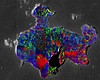
Product Information: This mosaic represents SELenological and Engineering Explorer (SELENE) Kaguya Multiband Imager (MI) derived submicroscopic metallic iron (SMFe; Taylor et al., 2010). The mosaic…
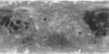
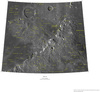
Product Information: This Multiband Imager (MI) 750nm mosaic is topographically corrected reflectance data acquired by the the SELenological and Engineering Explorer (SELENE) Kaguya mission. The MI…
Product Information: The Multiband Imager (MI) mosaics contain 34 mosaics in 32bit GeoTiff format of the topographically corrected reflectance data acquired by the MI in 9 spectral bands, 415, 750,…
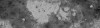
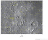
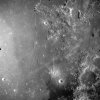
The Apollo Metric Mapping Cameras were carried on the Apollo 15, 16, and 17 missions to map Earth’s Moon with a high degree of geometric fidelity. This archive collection consists of 7247 usable…
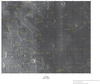
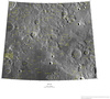
This raster dataset represents a confidence value or figure of merit (FOM) for each pixel for the digital elevation model (DEM) as extracted from the Lunar Reconnaissance Orbiter Camera (LROC) Narrow…