Mars Mariner 9 5M Quads GIS Conversion
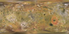
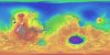
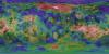
application/zip 44 MBThe 1:5,000,000-scale, Mariner-9 geological maps were the first to divide mars into 30 discrete latitudinal and longitudinal areas called the ‘Mars Charts’ (MCs) (Skinner et al., 2006, Gaither et…