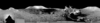
The panorama was collected by Charles Moss Duke at Station 5. John Watts Young is at the back of the rover adjusting the high-gain antenna. The panorama is made from the frame set AS16-108-17663 to…
The panorama was collected by Harrison H. "Jack" Schmitt at Station 4. Eugene Andrew Cernan is at the rover. This site features the unexpected orange soil discovered on this mission. The panorama is…
The panorama was collected by Harrison H. "Jack" Schmitt at Station 8. Eugene Andrew Cernan is in the distance collecting a set of panoramic photographs. The panorama is made from the frame set…
This paper presents techniques for automatic mapping of Mars landing sites using surface-based images, i.e., those taken by Mars landers and/or rovers. An innovative method for automatic tie point…
There are many similarities between the Mars Surveyor '01 (MS '01) landing site selection process and that of Mars Pathfinder. The selection process includes two parallel activities in which…
On 4 July 1997, the Pathfinder spacecraft landed on Mars near the mouth of the outflow channel Ares Vallis, located in the southern part of Chryse Planitia. Between July 4 and September 27, 1997, the…
The Mars Volatiles and Climate Surveyor (MVACS) instrument payload on the Mars Polar Lander includes two imagers designed and constructed at the Lunar and Planetary Laboratory at the University of…
To assist in landing site selection, we are compiling a suite of stereo images of potential landing sites for the 1998 and 2001 Mars landers. From these, we are using automated stereogrammetry…
This abstract describes progress in cartographic processing of data from the Imager for Mars Pathfinder (IMP) by the U. S. Geological Survey in the past year, and plans for advanced cartographic…
Viking Orbiter images were reprocessed using new techniques to produce a precision controlled, photomosaic map of the Mars Pathfinder landing site prior to landing. The difference between the…