This mosaic shows Mercury's colors as viewed by placing images from MESSENGER's 1000 nm, 750 nm, and 430 nm narrow-band filters in the red, green, and blue channel respectively. This is not what…
This mosaic shows Mercury's surface in "enhanced color," a term used to describe a color scheme created to emphasize color differences on Mercury's surface. This is not what Mercury would look like…
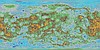
Product Information: This is a colorized shaded-relief of the original digital elevation model (DEM). Using the Integrated Software for Imagers and Spectrometers (ISIS3) and observations from…
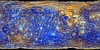
Product Information: Voyager 2 data was used to construct the best-ever global color map of Triton. This map has a resolution of 1,970 feet (600 meters per pixel [m]). Color was synthesized by…
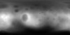
This mosaic represents the Thermal Emission Imaging System (THEMIS) -nighttime infrared (IR) 100 meter/pixel mosaic (version 12) released in the summer of 2014 by Arizona State University. Values…
Product Information: This product represents a near-global lunar topography from stereo image data acquired by the Wide-angle Camera (WAC) of the Lunar Reconnaissance Orbiter Camera (LROC) system…
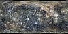
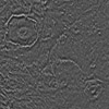
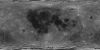
The Apollo Metric Cameras were carried on the Apollo 15, 16, and 17 missions to map Earth’s Moon with a high degree of geometric fidelity. This PDS volume contains the "Apollo 15, 16, and 17…
Product Information: Images from the European Space Agency's High Resolution Stereo Camera (HRSC) aboard the Mars Express were used to obtain 3-dimensional coordinates of surface points of Phobos.…
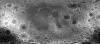
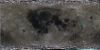
Product Information: The Clementine Ultraviolet/Visible (UVVIS) Version 2 mosaic is a grayscale data set representing the albedo (brightness of the lunar surface) as measured at the 750 nanometer…
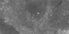
Product Information: The Clementine Ultraviolet/Visible (UVVIS) mosaic of Earth's Moon is a radiometrically and geometrically controlled, photometrically modeled global Mosaicked Digital Image Model…