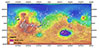
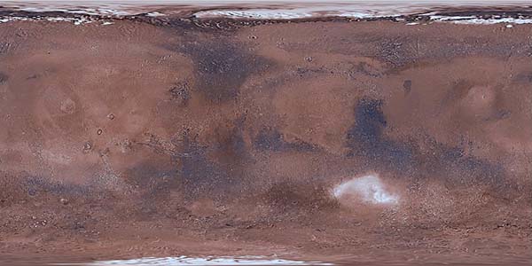
Product Information: This global image map of Mars has a resolution of 256 pixels/degree (scale approximately 232 meters per pixel (m) at the equator). The colorized mosaic was completed by NASA…
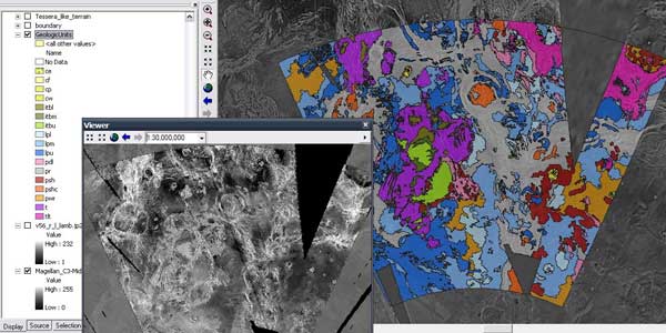
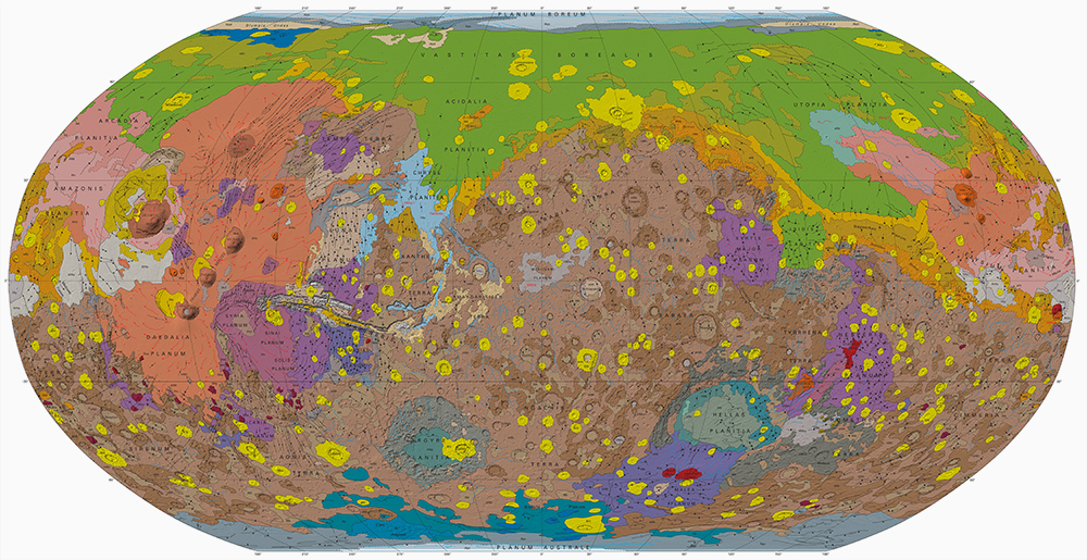
A digital adaptation of the hard-copy Viking Orbiter-based geologic maps of Mars. The western equatorial region was originally mapped by David H. Scott and K. L. Tanaka (USGS I-1802-A, 1986, 1:15M…
In 2003-2005, the USGS worked under the guidance of NASA's Mars Critical Data Products Initiative to conduct research on how controlled large area or global 2001 Mars Odyssey THEMIS IR image mosaics…
This mosaic represents the Thermal Emission Imaging System (THEMIS) -daytime infrared (IR) 100 meter/pixel mosaic (version 12) released in the summer of 2014 by Arizona State University. Values…
Product Information: This digital elevation model (DEM) is based on data from the Mars Orbiter Laser Altimeter (MOLA; Smith et al., 2001), an instrument on NASA’s Mars Global Surveyor (MGS)…
This product is a cartographically controlled mosaic of Mars Charts (MC) 08 through 23, covering 50.0 percent of Mars' surface, from -30 deg N to +30 deg N latitude and 0–360 deg E longitude. The…
This PDS4 archive includes 1,354 HiRISE DEMs, 1,354 CTX DEMs that overlap the HiRISE DEMs, orthoimages associated with each, and pixel masks to show the quality of each stereo correlation. DEMs…
Product Information: This PDS4-compliant archive contains version 2.0 Mars Reconnaissance Orbiter (MRO) Mars Color Imager (MARCI) Mars Daily Global Maps (MDGMs). Each MDGM is a daily global mosaic…
This orthorectified image was created by projecting an image from the Mars Reconnaissance Orbiter Context Camera (CTX) onto a Digital Terrain Model (DTM). The DTM is available under the “Derived…
This global image map of Mars has a resolution of 256 pixels/degree (scale approximately 231 m/pixel at the equator). The black-and-white mosaic is processed to emphasize local topographic…
Layers available for download from:USGS AstrogeologyData Portal: Astropediahistorical FTP downloads
GIS Video TutorialsIntroduction to GIS Data for ArcMap 10.1 and HigherOverview of the Geologic Map GIS TemplateTour of the Planetary Geologic Mapping Python ToolboxSOPs for Common Mapping Workflows…
Lunar Orbiter Lunar Control Network 2004 The USGS worked to digitize and restore a global set of Lunar Orbiter images and to assemble this into a global digital Lunar Orbiter mosaic of the Moon. A…
The U.S. Geological Survey has recently completed a final revised version of its 231 m/pixel global Viking image mosaic of Mars that has substantially improved geodetic accuracy compared to versions…
The Astrogeology Team at USGS provides coordination of NASA's planetary geologic mapping program. Geologic mapping investigations of any imaged planetary body (except Earth) are proposed to NASA's…
ISPRS is an international NGO devoted to the development of international cooperations for the advancement of knowlege, research, development and education in the Protogrammetry, Remote Sensing and…
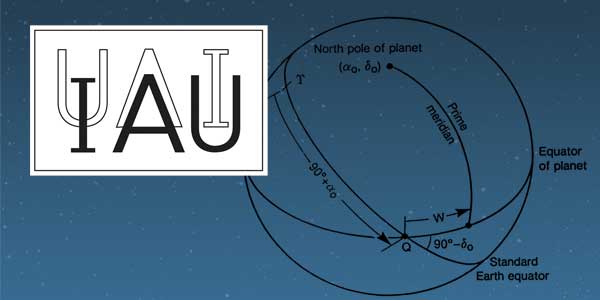
History: The IAU Working Group on Cartographic Coordinates and Rotational Elements of the Planets and Satellites was established as a consequence of a resolution adopted by Commissions 4 and 16 at…
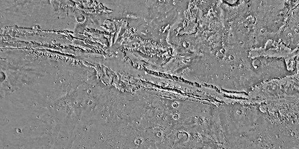
The Viking Orbiters acquired quality stereo coverage of a significant fraction of Mars in 1976-1980. Several groups have been using this stereo coverage to produce global and regional scale…
Following the successful landing of the Mars Pathfinder, DLR has carried out a comprehensive study of the Pathfinder landing site in terms of geology, mineralogy, and surface photometric properties.…
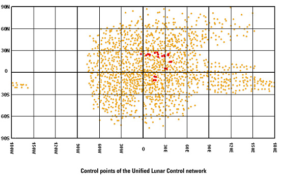
We recomputed the Viking Mars Control Point Network and derived Mars-fixed 3-dimensional coordinates of 3739 selected, globally distributed landmarks. The Mars Pathfinder coordinates and data from…
The Imager for Mars Pathfinder (IMP) obtained 5 full panoramic sets of images, varying in color and stereo coverage and degree of data compression, from the highly compressed First Look to the…
Imagery is the major source for our current understanding of the geologic and climatologic evolution of Mars. It has the potential to drastically enhance our knowledge in the future and is an…
Viking Orbiter images were reprocessed using new techniques to produce a precision controlled, photomosaic map of the Mars Pathfinder landing site prior to landing. The difference between the…
The Mars Orbiter Laser Altimeter (MOLA) on the Mars Global Surveyor (MGS) mission will produce a precision global geodetic control network for Mars of 30,000 - 50,000 points which will be accurate to…
The RAND control network of Mars was begun during the Mariner 9 mission, and it has been expanded and improved since then. The network is based on measurements of points made on images taken by the…
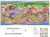
The map sheet "MARS 1:2,000,000 Mouth of Ares and Tiu Valles" presents the mapped area on the planet's northern hemisphere in two different cartographic categories. The Image Map, portraying the…
Described the exciting results which have been obtained from the initial set of mainly Northern hemispheric laser altimetry tracks from the MOLA instrument known as the SPO-1 phase. More recently has…