Products

24 Results Collapse
Rhea Nomenclature thumbnail

Rhea Nomenclature

application/pdf 921 kBApr 29 2011

Planetary nomenclature, like terrestrial nomenclature, is used to uniquely identify a feature on the surface of a planet or satellite so that the feature can be easily located, described, and…

Dione Nomenclature thumbnail

Dione Nomenclature

application/pdf 3 MBFeb 25 2011

Planetary nomenclature, like terrestrial nomenclature, is used to uniquely identify a feature on the surface of a planet or satellite so that the feature can be easily located, described, and…

Mimas Nomenclature thumbnail

Mimas Nomenclature

application/pdf 419 kBJul 13 2010

Planetary nomenclature, like terrestrial nomenclature, is used to uniquely identify a feature on the surface of a planet or satellite so that the feature can be easily located, described, and…

Tethys Nomenclature thumbnail

Tethys Nomenclature

application/pdf 2 MBJan 20 2009

Planetary nomenclature, like terrestrial nomenclature, is used to uniquely identify a feature on the surface of a planet or satellite so that the feature can be easily located, described, and…

Initial Global Control Network and Moasicking of ISS Images of Titan thumbnail

Initial Global Control Network and Moasicking of ISS Images of Titan

application/pdf 450 kB

The Cassini mission has returned an abundance of data about the surface of Titan. To maximize the science return from these data and to assist with planning for Cassini and future missions, we have…

Initial Global Control Network and Mosaicking Of ISS Images of Titan LPSC 2013 Poster thumbnail

Initial Global Control Network and Mosaicking Of ISS Images of Titan LPSC 2013 Poster

application/pdf 37 MB

The Cassini mission has returned an abundance of data about the surface of Titan. To maximize the science return from these data and to assist with planning for Cassini and future missions, we have…

Lorenz et al. 2013 Titan Topographic Map of Titan thumbnail

Lorenz et al. 2013 Titan Topographic Map of Titan

application/pdf 7 MB

Cassini RADAR SARtopo and altimetry data are used to construct a global gridded 1 x 1° elevation map, for use in Global Circulation Models, hydrological models and correlative studies. The data are…

Titan Cassini Global Controlled ISS Global Mosaic Presentation thumbnail

Titan Cassini Global Controlled ISS Global Mosaic Presentation

application/vnd.openxmlformats-officedocument.presentationml.presentation 19 MB

Titan Cassini GTDR Data thumbnail

Titan Cassini GTDR Data

application/zip 256 MB

These files are part of the Global Topographic Data Record (GTDR) series of Digital Map Products (DMP) produced by the Cassini RADAR Science Team. They contain a variety of different models for the…

Enceladus Cassini ISS Gridded Radius 2.2km v1 thumbnail

Enceladus Cassini ISS Gridded Radius 2.2km v1

application/isis 1 kBAug 28 2020

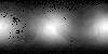
This 2.5D shape model of Enceladus was generated by interpolating the associated 3D point cloud of latitude, longitude, radius values, minus the mean radius of Enceldaus (251500 meters), to a regular…

Project Pages

3 Results Collapse

Documents

3 Results Collapse