Products

94 Results Collapse
Mars Control Network Solved for Parameters thumbnail

Mars Control Network Solved for Parameters

application/octet-stream 4 MB

Mars Control Network Solution paramaterization thumbnail

Mars Control Network Solution paramaterization

application/octet-stream 158 bytes

Viking MDIM 2,1 Image Reseau Positions thumbnail

Viking MDIM 2,1 Image Reseau Positions

application/octet-stream 12 MB

Mars MGS MOLA Global Shaded Relief 463m v1 thumbnail

Mars MGS MOLA Global Shaded Relief 463m v1

application/isis 990 MB

Product Information: This map is based on data from the Mars Orbiter Laser Altimeter (MOLA) (Smith, et al., 2001), an instrument on NASA’s Mars Global Surveyor (MGS) spacecraft (Albee, et al.,…

Mars Control Network Progress Output thumbnail

Mars Control Network Progress Output

application/octet-stream 272 kB

ISPRS 2004 Combined Bundle Adjustment of MOC Stereo Images and MOLA Altimetry Data for Precise Mars Topographic Mapping thumbnail

ISPRS 2004 Combined Bundle Adjustment of MOC Stereo Images and MOLA Altimetry Data for Precise Mars Topographic Mapping

application/pdf 184 kB

Launched in 1996, Mars Global Surveyor (MGS) carries two types of mapping equipments: Mars Orbiter Laser Altimeter (MOLA) and Mar Orbiter Camera (MOC). MOLA collects accurate laser altimetry data…

ISPRS 2003 Mapping Mars with Landmark Templates thumbnail

ISPRS 2003 Mapping Mars with Landmark Templates

application/pdf 557 kB

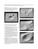
Viking Orbiter, MOC and MOLA data are being used to construct three dimensional landmark templates on Mars which can be aligned with a variety of data types for navigation on future missions and…

Project Pages

6 Results Collapse

Documents

16 Results Collapse