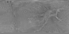
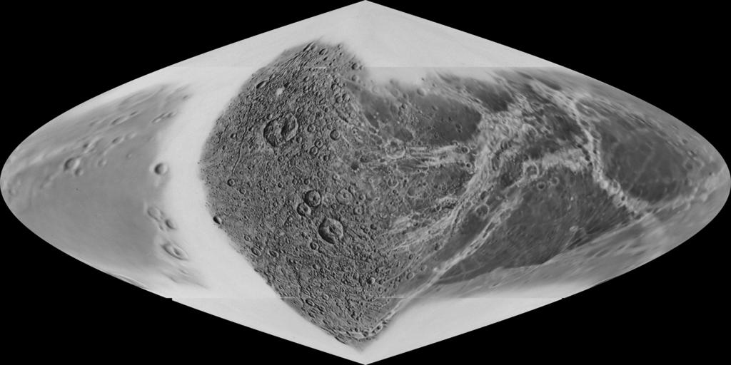
Dione Voyager Airbrush Mosaic 610m
This image mosaic is one of several products created as the first step of cartography planning in support of the Cassini-Huygens Mission to Saturn & Titan. The data included in this mosaic were collected by both Voyager I and Voyager II missions. The Cassini spacecraft is targeting Dione and other moons during the mission.
- Publisher
- USGS Astrogeology Science Center
- Originator
- USGS Astrogeology Science Center
- Group
- Added to Astropedia
- 9 January 2014
- Modified
- 11 May 2021
General
- Purpose
Airbrush or artist rendition of Dione.
- Geospatial Data Presentation Form
- Global Mosaic
- Online Linkage
- https://planetarymaps.usgs.gov/mosaic/Dione_Voyager_airbrush_sinu_610m.tif
- Native Data Set Environment
- ISIS v3
Keywords
- System
- Saturn
- Target
- Dione
- Theme
- Cartography
- Mission Specific
- Instrument
- ISS
Geospatial Information
- Minimum Latitude
- -90
- Maximum Latitude
- 90
- Minimum Longitude
- -180
- Maximum Longitude
- 180
- Direct Spatial Reference Method
- Raster
- Object Type
- Pixel
- Lines (pixels)
- 2880
- Samples (pixels)
- 5760
- Bit Type
- 8
- Quad Name
- Radius A
- 559000
- Radius C
- 559000
- Bands
- 1
- Pixel Resolution (meters/pixel)
- 609.77440741552
- Scale (pixels/degree)
- 16
- Horizontal Coordinate System Units
- Meters
- Map Projection Name
- Sinusoidal
- Latitude Type
- Planetocentric
- Longitude Direction
- Positive West
- Longitude Domain
- -180 to 180